
English| EUR
Suggested for you
More currencies
Choose a language
The 3 day ha giang loop covers roughly 350 kilometers of northern Vietnam's most remote mountain roads, crossing three districts and the Dong Van Karst Plateau. This guide maps the route segments, clarifies permit zones, and explains the daily windows that keep you ahead of weather and darkness.
Quick answer
The 3 day ha giang loop is a 350-kilometer motorbike circuit through Ha Giang Province, typically routed Ha Giang town → Quan Ba → Yen Minh → Dong Van (day one), Dong Van → Meo Vac → Du Gia (day two), and Du Gia → Ha Giang (day three). Most riders depart between 08:00–10:30 each morning to allow six to eight hours of daylight travel, accounting for photo stops at Ma Pi Leng Pass and lunch breaks in district towns.
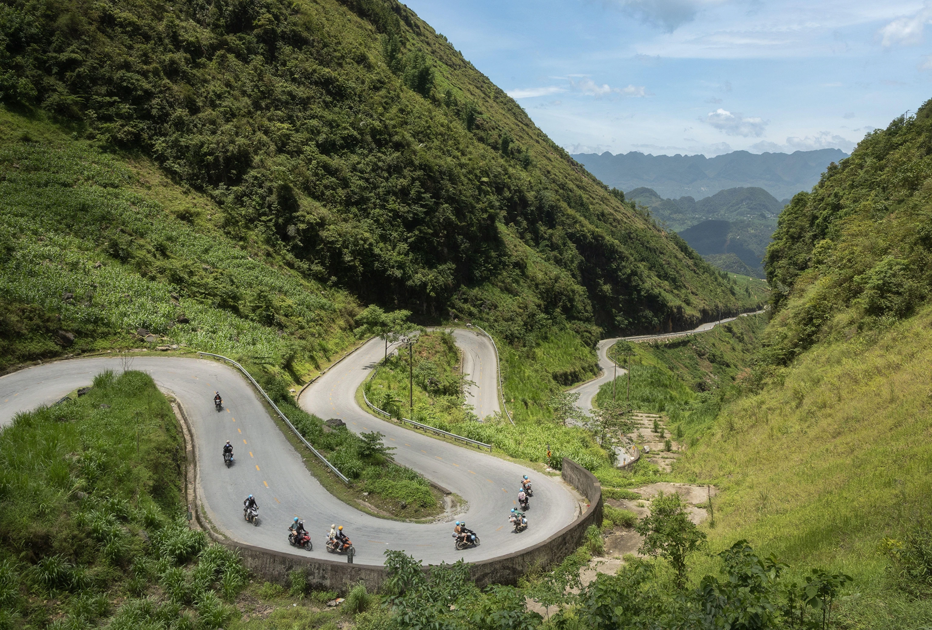
The Ha Giang loop operates on public roads with no entrance gate or single ticketing system. Riders pay only for fuel, guesthouses, and meals in roadside villages, plus a permit fee for the Dong Van Karst Plateau Geopark zone that covers roughly half the route. The three-day version became the default itinerary around 2018, when improved road conditions and the proliferation of hostels in Dong Van and Meo Vac made overnight stops predictable. Day one runs north from Ha Giang town through Quan Ba's twin hills and Yen Minh's limestone valleys, ending in Dong Van after seven to eight hours of riding. Day two tackles Ma Pi Leng Pass—the route's technical and scenic apex—before descending into Meo Vac and continuing to Du Gia or another village along the Nho Que River corridor. Day three completes the loop with a gentler southbound return via secondary roads that bypass the main QL4C highway. Each segment assumes dry-season riding; wet roads add one to two hours and close some viewpoints. The route's elevation spans 150 meters in the valleys to 1,500 meters at pass summits, with temperatures dropping ten degrees Celsius between Ha Giang town and the plateau. Most riders rent semi-automatic Honda Blades or manual Yamaha Sierras from rental shops clustered near the Ha Giang bus station, though guided convoys with support vehicles handle luggage transfer and mechanical breakdowns for groups preferring not to self-navigate. The northern loop's appeal lies in its access to Hmong and Tay villages that remain outside Vietnam's main tourism circuits, paired with engineering drama at cliff-edge switchbacks and river gorges. The loop remains open year-round, but fog from November through February obscures mountain views and makes riding conditions unpredictable. March through May and September through October deliver the clearest skies and the most stable road surfaces. Permit zones require passport presentation at checkpoints in Tam Son and near the Lung Cu flagpole, adding fifteen minutes to day-one travel time.
“The three-day version became the default itinerary around 2018, when improved road conditions and the proliferation of hostels in Dong Van and Meo Vac made overnight stops predictable.”
This route suits travelers seeking a manageable loop through Ha Giang's mountain landscapes, covering approximately 300 kilometers over three days with overnight stops in Quan Ba and Dong Van or Meo Vac.
Depart Ha Giang City by 08:00–09:00, ride north through Bac Sum Pass and the Heaven's Gate viewpoint. Arrive Quan Ba district by early afternoon, covering roughly 45 kilometers, and overnight in town.
Visit the twin karst peaks visible from Quan Ba town center and explore the surrounding valley. Settle into accommodation and prepare for the next day's longer ride.
Travel northeast through Yen Minh district, passing terraced fields and limestone plateaus—approximately 90 kilometers. Arrive Dong Van town by late afternoon; this is the longest riding day of the loop.
Ride the Ma Pi Leng Pass, which descends through switchbacks above the Nho Que River canyon—roughly 25 kilometers. Stop at viewpoints along the pass before reaching Meo Vac by midday.
Return south via a lower-elevation route through Du Gia and Yen Minh, covering approximately 140 kilometers. Plan to arrive back in Ha Giang City by early evening, completing the circuit.
The most favorable period to travel the Ha Giang Loop is during the spring months of March to May or the autumn months of September to November. These windows provide stable conditions and clear visibility for navigating the mountain roads.
Dry and mild, 15°C to 25°C. Pleasant temperatures and buckwheat flowers bloom in select areas during spring.
Cool and clear, 12°C to 22°C. Harvest season creates vibrant golden rice terraces across the mountain landscapes.
—
Plan your arrival between 08:00 and 10:30. This window ensures adequate daylight for navigating mountain passes and reaching your destination before dark.
Verdict: The best time to travel is during October, ensuring daily movement begins between 08:00 and 10:30 to maximize visibility and safety.
Ha Giang is located in the northern mountainous region of Vietnam. The most common approach for travelers is to take a bus from Hanoi to Ha Giang City.
Hanoi My Dinh Station to Ha Giang City Bus Station
Private transfer via CT05 and QL2
To ensure you are prepared for the loop, plan your travel to arrive in Ha Giang City within the best arrival window of 08:00–10:30. This timing provides sufficient duration for equipment rental and safety briefings before beginning the journey.
The Ha Giang Loop is a public road system, meaning there is no general admission fee to access the route. Costs for travelers instead hinge on individual entry fees for specific local attractions located along the loop.
Verdict: A typical traveler pays 0 VND for road access, with total costs depending on the number of specific cultural or historical sites visited.
Prepare these items before your three-day ride through Ha Giang's mountain roads.
The Ha Giang Loop demands more preparation than most travelers expect. These errors can derail your trip or create safety risks on the mountain roads.
Starting after 10:30 without accounting for mountain travel time
Depart between 08:00–10:30 each day to allow time for photo stops, navigation, and reaching your destination before dark. Mountain roads slow progress significantly.
Riding without valid motorcycle license or travel insurance
Secure an International Driving Permit before arrival and comprehensive travel insurance that covers motorbike accidents. Vietnamese police conduct license checks, and hospitals require payment guarantees.
Underestimating road difficulty and riding in rain
The loop includes steep gradients, hairpin turns, and gravel sections. If rain begins, reduce speed dramatically or wait it out—wet mountain roads become extremely hazardous.
Skipping fuel stops in remote sections
Fill your tank in Ha Giang city, Yen Minh, and Meo Vac. Fuel stations are sparse between towns, and running out means pushing your bike uphill for kilometers.
Wearing inadequate protection gear in cold or sun
Temperatures drop sharply at elevation and sun exposure is intense. Pack layered clothing, a windproof jacket, sunscreen, and a proper helmet regardless of season.
Everything you need to know about 3 day ha giang loop
A typical 3 day ha giang loop covers the essential mountain passes and local villages within a three-day timeframe. This duration allows for a balanced pace of riding and sightseeing through the northern frontier.
There is no single entrance fee for the 3 day ha giang loop as it follows the public road system. Travelers only pay small fees at specific local attractions or heritage sites encountered along the route.
The best arrival window is between 08:00 and 10:30 to ensure sufficient daylight for navigating winding mountain roads. Arriving during this period helps visitors reach their intended overnight destination before dark.
Many travelers find the Ha Giang motorbike excursion manageable with moderate experience, though steep gradients and hairpin turns require caution. You may choose to hire an experienced local guide to handle the navigation while you enjoy the scenery.
For your journey, bring sturdy footwear, layers for changing temperatures, rain gear, and personal identification documents for local registration requirements. Ensure you have a valid permit if you are a foreign national traveling in this border region.
The public roads constituting the Ha Giang loop are accessible 24 hours a day, seven days a week. You may transit through the province at any time, though travel is strongly discouraged at night due to limited visibility.
Essential Ha Giang Loop Tour Tips
Read more Tickets & toursHa Giang Loop Tour Groups
Read more GuideHa Giang Loop Tour Route Map
Read more GuideHa Giang Loop Tour Gallery
Read more Tickets & toursHa Giang Loop Tours from Hanoi
Read more Tickets & toursHa Giang Loop Tour Companies
Read more Tickets & toursHa Giang Loop Motorbike Tours
Read more GuideHa Giang Loop Tour Price & Cost Guide
Read more GuideBest Time to Do the Ha Giang Loop Tour
Read more