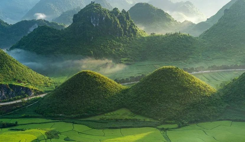
Quan Ba Heaven Gate
07:00–16:00
Capture the panoramic view of the twin mountains from the elevated platform looking south.

The Ha Giang Loop delivers 350 kilometers of serpentine mountain roads, terraced valleys, and limestone karst formations across northern Vietnam. This guide maps the viewpoints that matter, the lighting windows that work, and the practical considerations for documenting the journey.
Quick answer
Ha Giang Loop tour photos benefit most from shooting between 07:00 and 16:00, when clear daylight illuminates the Dong Van Karst Plateau and mountain passes remain navigable. The loop operates year-round with free access across all seven days, allowing photographers to plan multi-day circuits that prioritize golden-hour stops at Ma Pi Leng Pass, Lung Cu flagtower, and the Nho Que River canyon without entrance fees or restricted hours.
Seventy percent of travelers attempting Ha Giang Loop photography return with underexposed valley shots or motion-blurred hairpin turns because they misjudge the light drop in deep mountain corridors. The circuit crosses four districts across Ha Giang Province, climbing from 1,200 meters at Quan Ba to 1,600 meters at Dong Van, where afternoon cloud cover arrives two hours earlier than lowland forecasts suggest. Understanding this topographic light behavior separates documentary records from portfolio-grade loop photography. The road network itself opened to independent motorcyclists in 2016, transforming what was previously a restricted border zone into Vietnam's most photographed mountain route. Karst pinnacles rise directly from terraced buckwheat fields near Lung Tam, creating natural leading lines that compress well in 35mm to 50mm focal lengths. The Nho Que River canyon operates as the visual anchor—1,000-meter vertical drops flanked by limestone walls that catch side light between 08:00 and 10:00, before haze diffuses contrast. Photographers working this section typically shoot from the glass skywalk platform or the road shoulder 200 meters east, where a natural gap in the guardrail permits tripod setup without obstructing traffic. Capturing the Ha Giang motorbike circuit demands more logistical planning than technical skill. Dust from limestone gravel coats front lens elements within 40 kilometers of riding, requiring UV filters as physical shields rather than optical tools. Most riders complete the loop across three to four days, sleeping in Yen Minh, Dong Van, and Meo Vac—towns positioned to intercept sunrise and late-afternoon light at key passes. The ethnic minority villages that line the route photograph best during weekly markets, when H'mong and Dao residents descend from higher elevations in traditional indigo-dyed textiles. These markets rotate across towns on a fixed schedule, turning market-day timing into a decisive factor for cultural documentation. Vehicle permits became mandatory in 2022 for all foreign motorcyclists, requiring registration 48 hours before departure. This bureaucratic layer introduces no additional cost but constrains spontaneous route changes, as registered itineraries must match actual travel dates. The regulation affects photography workflow indirectly—riders cannot extend stays to wait out poor weather without filing amendments at district police posts. Local guide services navigate this system efficiently, trading some creative autonomy for streamlined permit handling and pre-scouted photo access points that independent riders often miss while navigating.
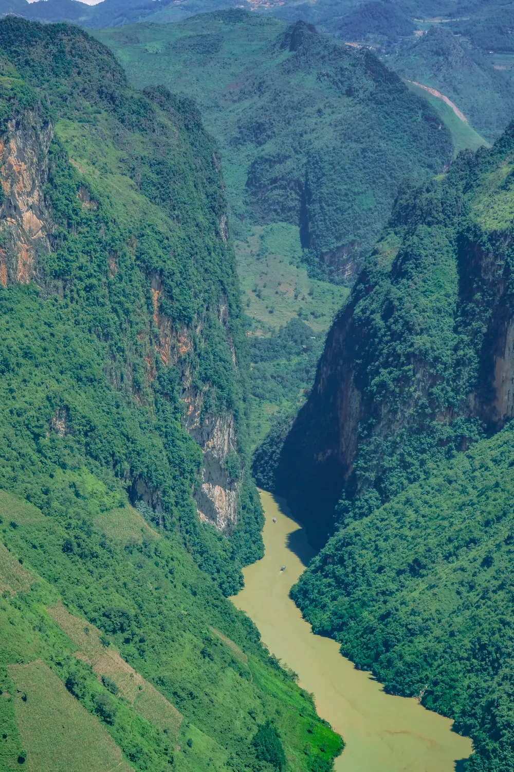
“The Nho Que River canyon catches side light between 08:00 and 10:00, before haze diffuses contrast across the 1,000-meter vertical frame.”
07:00–16:00
Capture the panoramic view of the twin mountains from the elevated platform looking south.
07:00–16:00
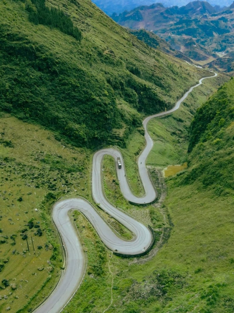
Photograph the winding serpentine road from the upper curves looking down at the traffic.
07:00–16:00
Position the camera to capture the Nho Que River deep within the canyon below the cliffs.
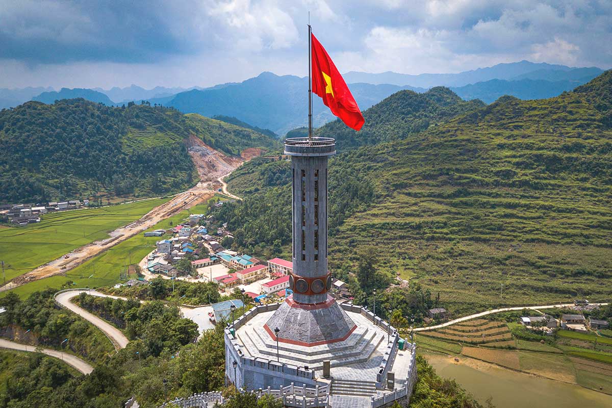
07:00–16:00
Frame the tall stone tower against the backdrop of the northern border mountains.
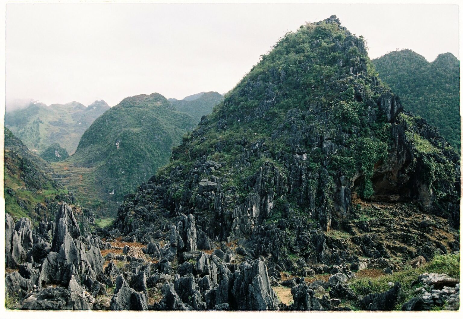
07:00–16:00
Focus on the jagged grey limestone rock formations that extend across the horizon.
The period from September to November provides the most consistent lighting and clear mountain visibility for photography. Travelers should prioritize the best arrival window of 07:00–16:00 to ensure sufficient daylight for navigating and capturing the landscape.
Harvest season, 20°C–25°C
Golden rice terraces cover the hillsides during this harvest period.
Cool and dry, 15°C–22°C
Buckwheat flowers bloom in pink and white fields across the plateau.
Mild spring, 18°C–24°C
Plum and peach blossoms create vibrant contrasts against the grey karst mountains.
—
This window offers optimal lighting conditions and safer road visibility for moving between viewpoints.
Verdict: For the best photography conditions, plan your trip between September and November and adhere to the daily travel window of 07:00–16:00.
The Ha Giang Loop is located in Ha Giang Province, Vietnam, and is best accessed by traveling to Ha Giang City. From the city, visitors typically secure local transport to navigate the public road network.
Hanoi My Dinh Station to Ha Giang City
Private transfer from Hanoi to Ha Giang City
Local motorbike rental within Ha Giang City
Plan your travel to reach the starting point within the best arrival window of 07:00–16:00 to ensure optimal visibility on mountain roads. The loop is a public road network with 0 VND entrance fee.
The Ha Giang Loop passes through ethnic minority villages where residents may not consent to photography. Respecting local customs and sacred sites preserves trust between travelers and communities.
The Ha Giang Loop is a public road network located in Ha Giang Province, Vietnam, and does not charge any entrance fees for access. Travelers do not encounter ticketed entry points while navigating these routes.
Verdict: A typical adult pays 0 VND for road access, as costs are limited to personal transport, fuel, and accommodation.
Everything you need to know about ha giang loop tour photos
Capturing great imagery involves balancing travel time with frequent stops at mountain passes and ethnic villages. While professional guides can assist with positioning, many travelers prefer documenting the journey through the limestone karst plateaus independently. Proper planning ensures you secure the best ha giang loop tour photos during the golden hours of light.
There is an entrance fee of 0 VND for the road network itself as it is a public infrastructure. You do not need to pay to pass through the scenic routes or take images of the landscape. Please respect local properties and public spaces while documenting your trip.
The best arrival window for light and safety is 07:00–16:00, providing the most consistent daylight for mountain photography. Traveling during these hours ensures better visibility on winding turns and more vibrant colors for your landscape shots. Avoiding dusk helps maintain safer road conditions for all travelers.
Many local guides and tour operators are accustomed to travelers needing time for photography and can help identify prime viewpoints. While you may book a guided excursion, these services focus on logistics and safety rather than professional photography. You should clarify your interest in frequent stops with your guide before departing.
A versatile lens capable of wide-angle shots is ideal for capturing the vast scale of the Ma Pi Leng Pass and surrounding canyons. Bringing spare batteries is essential, as the cold temperatures at high altitudes can drain power faster than usual. Keep your gear protected from dust and occasional rain common in northern Vietnam.
Safety is the priority when stopping for images on narrow mountain roads. Always pull completely off the main path in designated widened areas or viewpoints to avoid blocking traffic. Use caution on steep inclines and stay mindful of local motorbikes and heavy transport vehicles sharing the route.
Essential Ha Giang Loop Tour Tips
Read more Tickets & toursHa Giang Loop Tour Groups
Read more Guide3 Day Ha Giang Loop Itineraries
Read more GuideHa Giang Loop Tour Route Map
Read more Tickets & toursHa Giang Loop Tours from Hanoi
Read more Tickets & toursHa Giang Loop Tour Companies
Read more Tickets & toursHa Giang Loop Motorbike Tours
Read more GuideHa Giang Loop Tour Price & Cost Guide
Read more GuideBest Time to Do the Ha Giang Loop Tour
Read more