
English| EUR
Suggested for you
More currencies
Choose a language
The Ha Giang Loop spans roughly 350 kilometers of mountain roads through Vietnam's northernmost province, connecting Ha Giang City with hill-tribe villages, karst valleys, and border checkpoints. No single official map governs the route—riders navigate using GPS tracks, offline apps, and waypoint coordinates shared across traveler networks. This guide walks you through the core segments, critical junctions, and the navigation tools that work when cell service drops.
Quick answer
The Ha Giang Loop follows public provincial roads QL4C, QL4D, and QL2 in a circuit from Ha Giang City through Quan Ba, Yen Minh, Dong Van, Meo Vac, and back via Du Gia, with no entrance fee and 24-hour road access. Most riders complete the loop in three to four days, overnighting in Yen Minh or Quan Ba, Dong Van, and Meo Vac. GPS coordinates and offline map apps are essential—cell coverage is sparse beyond district centers, and road signage alternates between Vietnamese and occasional English transliterations.
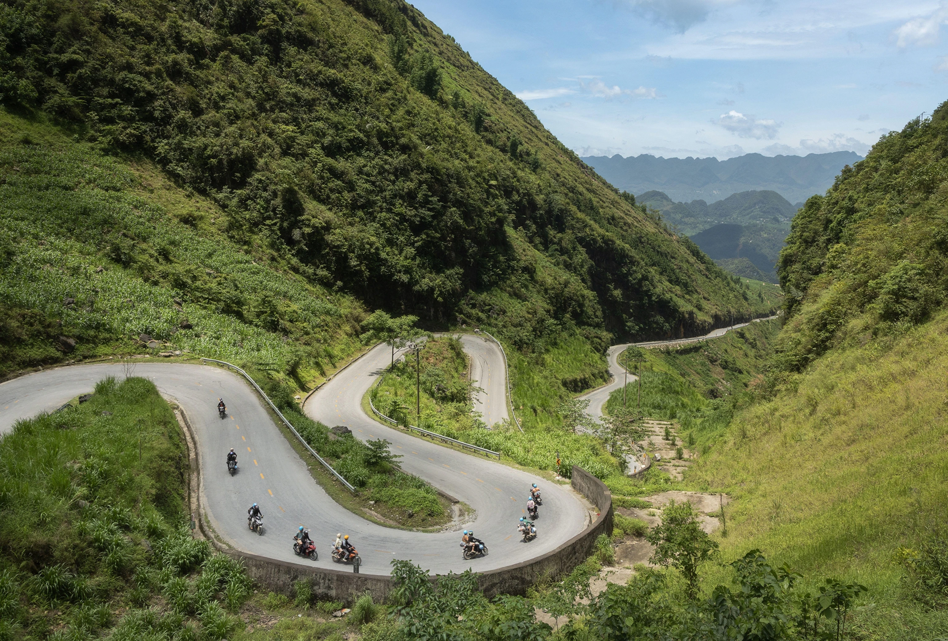
The Ha Giang Loop does not appear on most international road atlases, yet it carries more foreign motorbikes each dry season than any comparable route in northern Vietnam. The circuit threads through Dong Van Karst Plateau Geopark, a UNESCO-recognized landscape of limestone pinnacles, terraced fields, and villages where Hmong, Tay, and Dao communities still farm steep slopes using hand tools. Road conditions shift every few kilometers—smooth asphalt near Ha Giang City degrades to potholed sections approaching Dong Van, then narrows to single-lane ribbons carved into cliff faces on the descent from Ma Pi Leng Pass. A ha giang loop tour map typically divides the circuit into three legs. The first runs north from Ha Giang City to Dong Van via Quan Ba's Twin Mountains and the Heaven's Gate viewpoint, covering roughly 150 kilometers with sustained climbs above 1,400 meters. The second leg follows the Chinese border east to Meo Vac, crossing Ma Pi Leng Pass—the loop's highest and most exposed section—with sheer drops into the Nho Que River canyon. The final leg returns south through Du Gia and Yen Minh, rejoining QL4C for the descent back to Ha Giang City. Each overnight stop clusters around a district center where guesthouses, fuel stations, and repair shops serve the rider corridor. Navigation tools matter more than printed maps here. The loop route planning relies on offline GPS apps preloaded with OpenStreetMap data or GPX tracks exported from rider forums. Cell signal drops entirely between Yen Minh and Dong Van, and again on the Ma Pi Leng descent. Riders download Maps.me or OsmAnd before leaving Hanoi, marking waypoints for police checkpoints—foreigners register permits at Quan Ba, Yen Minh, and Dong Van—and fuel stops, which thin out east of Dong Van. Road markers use kilometer posts rather than street names, and junctions often lack signage. The Ha Giang Loop circuit follows a logical geographic arc, but without a loaded track or local guide, wrong turns add hours to daily distances already demanding in mountain terrain. The route network remains open year-round, though landslides during June-through-September monsoons periodically close sections of QL4C near Quan Ba and the approach to Ma Pi Leng. Local authorities clear roads within days, but real-time conditions do not propagate to mapping services. Riders confirm passability at guesthouses the evening before each leg, adjusting overnight stops when detours reroute through longer valley roads.
“The circuit threads through Dong Van Karst Plateau Geopark, a UNESCO-recognized landscape of limestone pinnacles, terraced fields, and villages where Hmong, Tay, and Dao communities still farm steep slopes using hand tools.”
The Ha Giang Loop is typically completed as a 3-to-4 day circuit from Ha Giang City, covering approximately 350 kilometers of mountain roads through northern Vietnam's most dramatic highland terrain. This route plan outlines the standard clockwise progression with overnight stops in key towns along the loop.
Depart Ha Giang City northward on QL4C, ascending to Heaven's Gate viewpoint before reaching Quan Ba Valley (approximately 45 kilometers). Plan 3-4 hours riding to allow for photo stops at the twin fairy mountains overlook.
Continue northeast through Yen Minh, then tackle the winding ascent to Dong Van via Ma Pi Leng Pass—the loop's most technical segment (approximately 80 kilometers total). This longest riding day requires 6-7 hours; most travelers overnight in Dong Van town near the stone plateau.
Head south from Dong Van to Meo Vac (20 kilometers), then follow the Nho Que River gorge westward on the dramatic clifftop road toward Du Gia or Ha Giang City (approximately 90 kilometers). The Ma Pi Leng segment between Dong Van and Meo Vac offers the loop's most exposed road conditions.
Complete the southern return leg through Du Gia back to Ha Giang City (approximately 120 kilometers), descending from high plateau back to valley elevations. Riders typically arrive by mid-afternoon, allowing time for motorbike return before evening.
Ha Giang City serves as the gateway to the loop, located in Ha Giang Province, Vietnam. Most travelers arrive from Hanoi via long-distance road transport.
Hanoi My Dinh Station to Ha Giang City Bus Station
Private transfer via CT05 and QL2
Local rental (motorcycle) from city center
Plan your arrival for the best arrival window of 08:00–16:00 to ensure optimal daylight visibility for mountain passes and safety on narrow roads.
The most favorable window for the Ha Giang Loop occurs during the dry months of March to May and September to November. Planning travel within these months ensures stable mountain conditions and optimal road visibility.
Dry, 15°C–25°C
Spring brings mild temperatures and stable weather for navigating mountain passes.
Cool, 10°C–20°C
Autumn features clear skies and the rice harvest, ideal for landscape visibility.
Cold, 5°C–15°C
Winter months can reach near-freezing temperatures with frequent fog, complicating road safety.
Daylight
Adhere to the best arrival window of 08:00–16:00 to maximize visibility on narrow roads.
Verdict: For the safest and clearest experience, travel between March and May or September and November, strictly adhering to the 08:00–16:00 daily daylight window.
The Ha Giang Loop is a public road network located in Ha Giang Province, Vietnam. Access to these roads does not require a formal entrance ticket.
Verdict: The entry fee for the loop is 0 VND, though travelers must budget for optional vehicle rentals and accommodation.
The Ha Giang Loop road network is a public infrastructure system accessible 24 hours a day throughout the week. While the routes remain open at all times, travelers should plan their movement according to safety guidelines.
Most first-time riders underestimate the technical demands of navigating narrow mountain passes and permit requirements. These errors turn manageable routes into safety risks and logistical delays.
Skipping motorcycle inspection before departure
Check tire pressure, brakes, headlights, and fuel capacity the morning you leave Ha Giang City. Roadside repairs above 2,000 meters are sparse and expensive.
Riding without the Dong Van Karst Plateau permit
Obtain your permit (free for Vietnamese nationals, 40,000–80,000 VND for foreigners) at Ha Giang immigration office or through your accommodation before entering the geopark zone. Checkpoints enforce this.
Underestimating daily riding hours on the map
Account for 15–25 km/h average speeds on switchback sections, not the 40+ km/h possible on flat roads. A 120 km day often requires 6–7 hours of riding time.
Following digital maps offline without verifying route conditions
Download up-to-date OpenStreetMap layers and cross-reference with your accommodation about current road work or landslide closures. Satellite routes may show impassable tracks.
Ignoring fuel range between stations
Fill your tank in Ha Giang City, Quan Ba, Yen Minh, Dong Van, and Meo Vac. Gaps exceed 50 km in remote stretches where small roadside vendors may be closed or out of stock.
Everything you need to know about ha giang loop tour map
A ha giang loop tour map serves as a vital navigation tool for travelers exploring the northern highlands of Vietnam. It identifies key limestone formations, mountain passes, and local ethnic villages along the road network.
No, the road network itself is public, so there is no fee for using a ha giang loop tour map. Entrance fee: 0 VND (Free entry; open public road network.)
The terrain is challenging with steep mountain passes and narrow roads that require advanced motorcycle skills. Most travelers opt for a guided experience with an "easy rider" or local driver to ensure safety on these hairpin turns.
A useful guide should highlight fuel stations, accommodation spots in towns like Dong Van or Meo Vac, and essential viewpoints. Ensure your map displays current road conditions and clearly marks elevation changes across the region.
Yes, the best arrival window is 08:00–16:00 to maintain optimal daylight visibility for mountain passes. Navigating narrow roads after dark is discouraged due to safety concerns and visibility limitations.
While possible, traveling with children on the loop is physically demanding due to long hours on a motorbike. Families often prefer a private car tour to navigate the winding roads of the Ha Giang province safely.
The biggest mistake is overestimating your driving ability or ignoring weather conditions that affect visibility on the mountain passes. Always verify the latest information for the Ha Giang province before departure to avoid getting stranded in remote areas.
Essential Ha Giang Loop Tour Tips
Read more Tickets & toursHa Giang Loop Tour Groups
Read more Guide3 Day Ha Giang Loop Itineraries
Read more GuideHa Giang Loop Tour Gallery
Read more Tickets & toursHa Giang Loop Tours from Hanoi
Read more Tickets & toursHa Giang Loop Tour Companies
Read more Tickets & toursHa Giang Loop Motorbike Tours
Read more GuideHa Giang Loop Tour Price & Cost Guide
Read more GuideBest Time to Do the Ha Giang Loop Tour
Read more